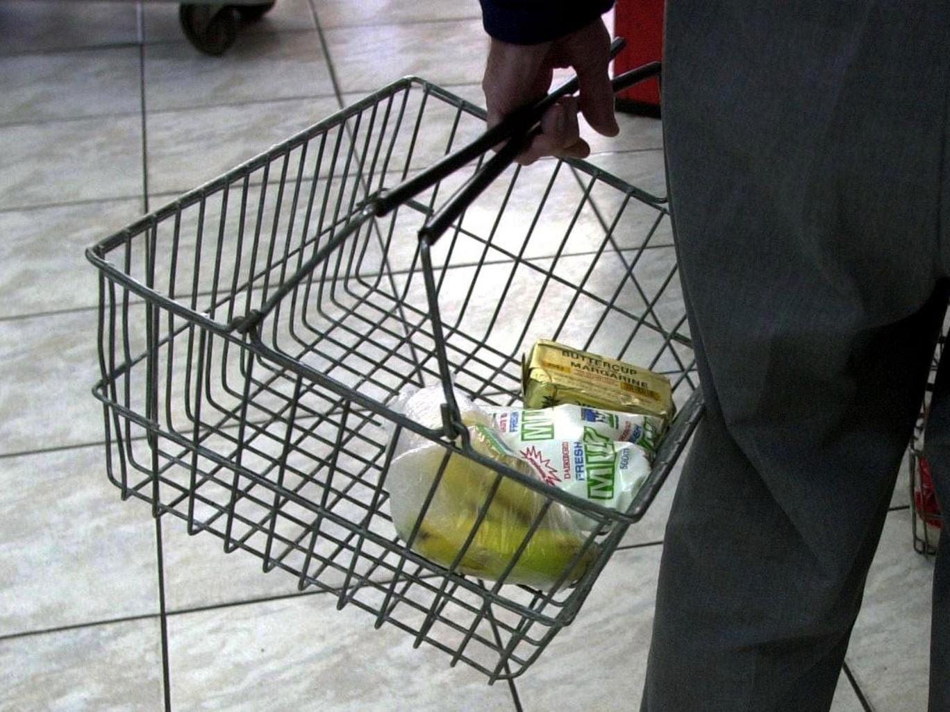
Currently about 50 million Americans meet the USDA criteria for food insecurity. About 15 million of them are children.
While
the official end of the Great Recession is a full five years behind us,
there are now nearly 12 million more Americans who lack enough
resources to access adequate food than there were in 2007, a number that
has only improved slightly since United States food insecurity peaked at over 21 percent in 2009. These statistics alone are disturbing. But as detailed in a new study released today as part of Bread for the World Institute’s 2016 Hunger Report, absence of food security in the U.S. carries enormous healthcare costs, more than $160 billion in 2014.
Using
data from the U.S. Department of Agriculture (USDA), Census Bureau and
research on food security published in peer-reviewed academic journals
between 2005 and 2015, a team of researchers led by Boston University
School of Medicine associate professor of pediatrics John Cook,
estimated these health care costs by looking at the costs of treating
diseases and health conditions associated with household food insecurity
plus earnings lost when people took time off work because of these
illnesses or to care for family members with illnesses related to food
insecurity.
As Cook, who is also research scientist and principal investigator with Children’s Health Watch, explained to In These Times,
lack of access to adequate food does not necessarily directly cause a
particular illness but “plays a role in that disease occurring.” Years
of research consistently shows food insecurity increases the risk for a
range of health problems. These risks are particularly great for
children but poor and inadequate nutrition also increases risk for adult
health problems, including obesity and chronic diseases, among them
diabetes, hypertension and cardiovascular disease. It also exacerbates
illness duration and severity–in some cases simply because people lack
money for medication–and therefore treatment costs.
Putting this
in a broader economic context, Bread for the World Institute points out
that the U.S. “spends more per capita on health care than any other
high-income country but compares poorly with these others on key
population health indicators such as life expectancy and child survival.
This is due,” report authors, “in part to our tolerance as a nation,
for higher levels of poverty and hunger.”
Currently about 50 million Americans meet the USDA criteria for food insecurity. About 15 million of them are children. In 2014, 19.2 percent
of U.S. households with children were food
insecure–about a third
higher than households without. The Boston University research team
found if the costs of special education for children whose learning
abilities are adversely affected by food insecurity are factored in
along with related education impacts for high-schoolers, the $160
billion rose by an additional nearly $18 billion. This brings a total
estimate of direct and indirect health care costs of U.S. food
insecurity in 2014 to $178.93 billion.
Fundamentally,
biological warfare is sneaky. It involves a microbial sucker punch to
its intended target, often accomplished in a manner in which the
aggressor can claim clean hands, while his victim may suffer or die.
Biological
warfare can take a number of forms. The question—how can you get a
bacteriological or toxic agent on board without the target being
alerted– has been asked and answered. In addition to using humans and
animals as vectors, biological warfare agents can be airborne,
waterborne, foodborne or put into pharmaceuticals.
Substantial
concerns have been voiced concerning the potential for inserting
bioweapons into vaccines. Indeed, given the history of known
contaminated vaccines, this is hardly a matter of speculation. Polio
vaccines have been found to contain cancer. A Merck rotavirus vaccine
was found to be contaminated with a pig virus. Another Merck product,
the Hepatitis B vaccine, was reported to have been laced with the AIDS
virus. In addition, a tetanus vaccine distributed in the Third World was
found to contain human chorionic gonadotrophin, an anti-fertility agent
known to produce spontaneous abortions.
The correlation between the rise in vaccinations of children and autism has become an urban legend.
A
Bill has just passed the US Senate, mandating that the US Department of
Veteran Affairs ensure that all veterans receive immunizations
(vaccines) per a draconian schedule. At this juncture, active military
must receive over a dozen vaccines. This piece of legislation is
therefore an effort to extend the vaccine mandate to those who have
previously served their country.
(KPIX 5) — This might come as a surprise to California natives in their 20s and early 30s: The state owns your DNA.
Every
year about four million newborns in the U.S. get a heel prick at birth,
to screen for congenital disorders, that if found early enough, can
save their life.
Danielle Gatto barely remembers the nurse even
mentioning test performed on her two daughters. “I don’t think that any
woman is in a state of mind to sit down and start studying up on the
literature they send you home with,” she said.
But later she was
shocked to find, her daughters’ leftover blood was not thrown away. “The
state collects the cards and then uses them in a database,” she said.
The information is buried on page 12 of the brochure about the Newborn
Screening Program that hospitals give parents of newborns before they go
home.
Turns out a non-descript office building in Richmond
contains the DNA of every person born in California since 1983. It’s a
treasure trove of information about you, from the color of your eyes and
hair to your pre-disposition to diseases like Alzheimer’s and cancer.
While cases of malnutrition doubled in the four years to 2014, there
has been a rise in diseases that were rife in the Victorian era such as
scurvy, scarlet fever, cholera and whooping cough Corbis
Cases
of malnutrition and other “Victorian” diseases are soaring in England,
in what campaigners said was a result of cuts to social services and
rising food poverty.
NHS statistics show that 7,366 people were
admitted to hospital with a primary or secondary diagnosis of
malnutrition between August 2014 and July this year, compared with 4,883
cases in the same period from 2010 to 2011 – a rise of more than 50 per
cent in just four years.
Cases of other diseases rife in the
Victorian era including scurvy, scarlet fever, cholera and whooping
cough have also increased since 2010, although cases of TB, measles,
typhoid and rickets have fallen.
Chris Mould, chairman of the
Trussell Trust, which runs a nationwide network of foodbanks, said they
saw “tens of thousands of people who have been going hungry, missing
meals and cutting back on the quality of the food they buy”.
The shocking impact of recession and austerity on England’s poorest
people has come to light again in figures showing the number of
malnutrition cases treated at NHS hospitals has nearly doubled since the
economic downturn Rex
The
shocking impact of recession and austerity on England’s poorest people
has come to light again in figures showing the number of malnutrition
cases treated at NHS hospitals has nearly doubled since the economic
downturn.
Primary and secondary diagnoses of malnutrition – caused
by lack of food or very poor diet – rose from 3,161 in 2008/09 to 5,499
last year, according to figures released by the health minister Norman
Lamb.
While the data does not include information on the
circumstances of each diagnosis, the rise coincides with a dramatic
increase in the cost of living, and a spike in demand for charity food
hand-outs.
The figures, broken down by region, reveal the heaviest
burden of hunger is being felt in rural areas. Hospitals in Somerset
saw the most cases, with 215 diagnoses, followed by Cornwall and Scilly
Isles.
In a recent article titled "Monsanto GM Soy is Scarier than You Think," Mother Jones1 went into some of the details surrounding our genetically engineered (GE) food supply.
Soybeans
are the second-largest food crop grown in the US, and more than 90
percent of it is genetically engineered. Some have been modified to
withstand the herbicide Roundup (i.e. Roundup-Ready soy), while other
varieties have been designed to produce its own pesticide, courtesy of
the Bt gene (so-called Bt soy).
As noted in the featured article,
organic soy production is miniscule, accounting for less than one
percent of the total acreage devoted to soy in the US. The rest is
conventionally grown non-GE soy.
Even if you don't buy soy
products such as tofu or soy milk, you're undoubtedly consuming plenty
of soy if you're eating any processed foods and/or meats from animals
raised in confined animal feeding operations (CAFOs). A large portion of
the GE soy grown actually ends up in your meat, as soy is a staple of
conventional livestock feed. Much of the rest ends up as vegetable oil.
According to the US Soy Board,
soybean oil accounts for more than 60 percent of all the vegetable oil
consumed in the US—most of which is used in processed foods and fast
food preparation. As noted in the featured article:2
"Given soy's centrality to our food and agriculture systems, the findings of a new study published in the peer-reviewed journal Food Chemistry3are worth pondering. The
authors found that Monsanto's ubiquitous Roundup Ready soybeans...
contain more herbicide residues than their non-GMO counterparts. The
team also found that the GM beans are nutritionally inferior."
New Research Questions Quality and Safety of GE Soybeans
Three varieties of Iowa-grown soybeans were investigated in this study:4
Roundup Ready soybeans
Non-GE, conventional soybeans grown using Roundup herbicide
Organic soybeans, grown without agricultural chemicals
All
of the Roundup Ready soybean samples were found to contain residues of
glyphosate, which is the active ingredient in Roundup, along with its
amino acid metabolite, aminomethylphosphonic acid (AMPA).
On
average, GE soy contained 11.9 parts per million (ppm) of glyphosate.
The highest residue level found was 20.1 ppm. Meanwhile, no residues of either kind were found in the conventional non-GE and organic varieties.
In
terms of nutrition, organic soybeans contained slightly higher levels
of protein and lower levels of omega-6, compared to both
conventionally-grown non-GE and GE soy. Similar results were found in a
2012 nutritional analysis of GE corn, which was found to contain 13 ppm of glyphosate, compared to zero in non-GMO corn.
It may be worth noting that the US Environmental Protection Agency (EPA) actually raised the allowable levels of glyphosate5, 6 in oilseed crops such as soy, from 20 ppm to 40 ppm
just last summer. It also raised the levels of permissible glyphosate
contamination in other foods—many of which were raised to 15-25 times
previous levels!
Why Glyphosate Contamination Matters
Nearly
one BILLION pounds of Roundup are used each year for conventional crop
production around the globe, but genetically engineered (GE) crops see
some of the heaviest use. This is especially true for Roundup Ready
crops, which are designed to withstand otherwise lethal doses of this
chemical.
The issue of glyphosate contamination is well worth considering if you value your health. Recent research suggests glyphosate may in fact be an instrumental driver of many chronic diseases, and in my view, avoiding glyphosate is a major reason for buying organic, in and of itself.
Labeling GMOs
could help you select products that are less likely to have heavy
contamination, although you'd also avoid many other hazardous chemicals
used in conventional farming by opting for products labeled 100%
organic.
It's important to understand that these glyphosate
residues CANNOT be washed off, as the chemical is actively integrated
into every cell in the plant. Dr. Don Huber, who is one of the most
prominent scientific experts in plant toxicology, firmly believes
glyphosate is FAR more toxic and dangerous than DDT. A number of other
studies have raised serious questions about the safety of glyphosate,
including but not limited to the following:
Research published in the International Journal of Toxicology7
in January revealed that glyphosate-based formulations like Roundup
pose a threat to human health through cytotoxicity and oxidative
effects. Such formulations were also found to be lethal to human liver
cells
A 2012 study8 found that 3 ppm of Roundup in water induced morphological changes in frogs
A German study9 on poultry, published in 2013, showed that glyphosate tends to be more harmful to beneficial gut bacteria like Lactobacillus, while pathogenic bacteria like Salmonella entritidi
tend to be largely resistant to the chemical. Subsequently, the
microbial balance tends to shift toward pathogenic overgrowth when
exposed to glyphosate, and can predispose the animal to botulism
Victory! Vermont Passes First Effective GMO-Labeling Bill
On
April 16, 2014, the Vermont Senate passed the first no-strings-attached
GMO labeling bill (H.112) by an overwhelming margin—28-2. The bill
sailed through a House/Senate conference committee and was approved by
the House of Representatives on April 23.
Governor Shumlin has
already indicated he will be signing the bill into law—which will
require any genetically engineered food sold in Vermont to be labeled by
July 1, 2016.10
Food served in restaurants, alcohol, meat, and dairy products would be
exempt from labeling however. Foods containing GMO ingredients would
also not be allowed to be labeled "natural."
"I am proud of Vermont for being the first state in the nation to ensure that Vermonters will know what is in their food," Governor Shumlin said in a statement. "The
Legislature has spoken loud and clear through its passage of this bill.
I wholeheartedly agree with them and look forward to signing this bill
into law."
This is truly an historical moment
that will likely reverberate across the US in coming years. As noted by
Ronnie Cummins in a recent Huffington Post article:11
"Strictly
speaking, Vermont's H.112 applies only to Vermont. But it will have the
same impact on the marketplace as a federal law. Because national food
and beverage companies and supermarkets will not likely risk the ire of
their customers by admitting that many of the foods and brands they are
selling in Vermont are genetically engineered, and deceptively labeled
as 'natural' or 'all natural' while simultaneously trying to conceal
this fact in the other 49 states and North American markets. As a seed
executive for Monsanto admitted 20 years ago, 'If you put a label on
genetically engineered food you might as well put a skull and crossbones
on it.'"
The Burlington Free Press12
recently ran an excellent article on how the Vermont GMO labeling bill
was won. I would highly encourage you to read it in its entirety, to get
a real-world view of just how effective a grassroots campaign can be.
It really boils down to letting your representatives know what you want.
Despite the threat of a lawsuit from food manufacturers, Vermont
legislators realized that their constituents were serious about wanting
GMOs labeled. And they voted accordingly. Indeed, the chemical
technology and food industry knows this, which is why they've fought
tooth and nail to stop any and all GMO labeling efforts in the US.
They've even threatened to sue any state that passes a labeling law—a
threat taken seriously by Vermont.
Vermont Braces for Legal Challenge
Vermont
Senate agreed to establish a state defense fund to pay for legal costs
associated with defending the law against any legal challenge by the
food industry, which will undoubtedly be spearheaded by the Grocery
Manufacturers Association (GMA). It's unlikely that the industry would
win such a legal challenge, however. As reported by the Burlington Free Press:13
"Rep.
Teo Zagar, D-Barnard, told House members that... changes the Senate
made will help the state prevail in court. 'This bill has been
re-engineered to be more resistant to legal challenge,' he said."
As you may recall, after getting caught laundering money
and narrowly defeating the Washington labeling campaign, the Grocery
Manufacturers Association (GMA) sued the state of Washington, arguing
they should be allowed to hide their donors—which is a direct violation
of state campaign disclosure laws—in order to "speak with one voice" for
the interests of the food industry.14 I subsequently named the GMA "the most evil corporation on the planet,"
considering the fact that it consists primarily of pesticide producers
and junk food manufacturers who are hell-bent on violating some of your
most basic rights, just to protect their own profits.
The GMA was initially forced to reveal their donors, but has since removed their online membership list—again
hiding their members to prevent consumer awareness of who is behind
this radical front group. You can find the cached members list on
web.archive.org15
however. Not surprisingly, Pepsi, Coke, and Nestle—top purveyors of
chronic ill health—were the top funders trying to hide their identity
during the Washington State GMO labeling campaign.
Governor Andrew Cuomo at the inauguration of
New York City's Mayor Bill de Blasio on January 1, who has set a
liberal agenda. Photograph: Spencer Platt/Getty Images
New York is poised to become the latest US state to relax its laws
covering marijuana. Governor Andrew Cuomo will make a surprise
turnaround in policy later this week, to allow limited use of the drug
for medical purposes.
As Colorado residents continue to flock to their local pot shops, after their state became from 1 January the first to allow the sale and possession of cannabis for recreational purposes,
signs have emerged that New York will now make a small but important
amendment to some of the strictest laws on the drug in the US. Cuomo is
expected to announce an executive action in his annual state of the
state address on 8 January, to permit a small number of hospitals to
prescribe marijuana for medical use in the treatment of serious
illnesses including cancer and glaucoma, the New York Times reported on Sunday.
Cuomo, a Democrat, has always been staunchly against legalising
cannabis, including for medical use. Even though the likely announcement
would only loosen restrictions on the drug very slightly, it will be
seen as a significant move at a time when a number of states are
liberalising their laws in ways ranging from the use of medical
marijuana to decriminalising basic possession of the drug, up to full
recreational use. Voters in Washington state have also voted to allow
recreational marijuana and it is expected to follow Colorado later this
year and become the second state to implement such laws.
More than 20 states currently have laws allowing a variety of medical uses of marijuana.
Cuomo is expected to emphasise that medical marijuana will only be
allowed for a tightly circumscribed list of illnesses, to be drawn up by
the state Department of Health.
By announcing a unilateral executive action, the governor will
sidestep the legislative process in the state capital, Albany, where the
senate has repeatedly struck down bills passed in the lower assembly to
permit medical marijuana.
Ethan Nadelmann, the executive director of the Drug Policy Alliance,
told the New York Times Cuomo’s move was “bold and innovative”.
Even limited medical marijuana use is banned under federal law but
the Obama administration has signalled that it is not interested in
actively pursuing prosecution in states that have relaxed their laws
around the drug. Whether there will be any clash between federal law enforcement and state authorities in Colorado and Washington state remains to be seen.
20 Examples Of How America Is Rapidly Going Down The Toilet
By Michael, on June 13th, 2013
Deep
corruption is eating away at every level of American society like
cancer. We can see this in our families, we can see this in our
businesses, and we can especially see this in our government. We have
the highest rate of divorce in the world, we have the highest rate of
teen pregnancy in the world, we have the highest rate of obesity in
world, and nobody has higher rates of cancer, heart disease and diabetes
than we do. The suicide rate is soaring and our economy is falling
apart. Meanwhile, our politicians seem absolutely clueless and we have
piled up the biggest mountain of debt that the world has ever seen. Has
America ever been in such bad shape before? The following are 20
examples of how America is rapidly going down the toilet… #1 Why do so many members of the media have family
members that work for the White House? Is this one of the reasons why
the mainstream media is so soft on Obama? Just check out the following
list which was recently compiled by the Washington Post…
The list of prominent news people with close White House relations includes ABC News President Ben Sherwood,
who is the brother of Elizabeth Sherwood-Randall, a top
national-security adviser to President Obama. His counterpart at CBS,
news division president David Rhodes, is the brother of Benjamin Rhodes, a key foreign-policy specialist. CNN’s deputy Washington bureau chief, Virginia Moseley, is married to Tom Nides, who until earlier this year was deputy secretary of state under Hillary Rodham Clinton.
Further, White House press secretary Jay Carney’s wife is Claire Shipman, a veteran reporter for ABC. And NPR’s White House correspondent, Ari Shapiro, is married to a lawyer, Michael Gottlieb, who joined the White House counsel’s office in April.
#2 Why are IRS agents training with AR-15 rifles? Exactly who do those IRS agents expect to be using those weapons against? #3 The city of Detroit is on the verge of declaring
the largest municipal bankruptcy in U.S. history, but a 41-year-old city
worker is about to starting drawing a $96,000 annual pension…
Matt Schenk isn’t your average retiree. He’s 41, works
full-time and collects $194,000 a year at the Detroit Water and Sewerage
Department.
But as soon as next month, he’ll start collecting an estimated
$96,000 annual pension, courtesy of an early retirement incentive
offered to Wayne County appointees. It had no age restriction.
#4 The number of sexual assaults in the U.S. military is up 35 percent since 2010. #5 The suicide rate for Americans between the ages of 35 and 64 rose by close to 30 percent
between 1999 and 2010. The number of Americans that are killed by
suicide now exceeds the number of Americans that die as a result of car
accidents. #6 The United States has the highest rate of obesity on the planet by far. The U.S. also has the highest rate of cancer, the highest rate of heart disease and the highest rate of diabetes. #7 An illegal immigrant brutally raped and killed a 9-month-old girl
in Richland, Washington recently, but you won’t hear anything about it
from the big mainstream news networks because it might hurt the
immigration bill being pushed through Congress. #8 Even though the United States has been able to
fully secure the border between North Korea and South Korea for the past
60 years, U.S. Senator Check Schumer says that it would take “years and years and years” to secure the border between the United States and Mexico. #9 All over America illegal immigrants are turning pleasant communities into crime-infested cesspools. The following is what Doug Hoagland says is going on down in California…
This investigation by Mike Adams, the Health
Ranger, reveals why you are 6200% more likely to be killed by your
doctor than by a homicidal shooter. This is based on U.S. government
statistics from the Centers for Disease Control, combined with
doctor-caused deaths published in the Journal of the American Medical
Association.
These data show that FDA-approved prescription drugs kill 290
Americans every single day, meaning that for mass shootings to approach
that number, you’d have to see a Colorado Batman movie massacre take
place EVERY HOUR of every day, 365 days a year.
That’s how dangerous doctors and FDA-approved prescription medications really are. Read more at: http://www.naturalnews.com
GOLD BEACH, Ore. – Six earthquakes between magnitude 1.6 and 2.1
rumbled under the ocean less than 20 miles off the Oregon Coast in the
last week, according to U.S. Geologic Survey records.
The most recent – and most powerful – hit early Tuesday morning.
And two quakes over 4.0 shook last week about 240 miles off Bandon.
Small quakes hit Oregon on a regular basis, both on and off coast.
Last Thursday, for example, a magnitude 1.4 shook 8 miles northeast
of Springfield, and a 1.5 magnitude earthquake rumbled 11 miles east of
Woodburn just before 9:30 a.m. Tuesday morning.
But for residents of the Oregon Coast, earthquakes – and the tsunamis
they can trigger – have taken on renewed importance since March 2011.
The earthquake and tsunami that devastated parts of Japan last year
caused damage on the Oregon Coast and continue to deliver debris to
Northwest beaches.
The USGS told KCBY News that the recent swarm of quakes pose little
tsunami risk. The plates involved move sideways instead of up and down,
and earthquakes under magnitude 6 are not likely to generate tsunamis.
University of Nevada – Reno seismologist Glenn Biasi spent eight days in
the dense forests on the western side of the Southern Alps on the South
Island of New Zealand to study the Alpine Fault, among the world’s
longest, straightest and fastest moving plate boundary faults. Photo
courtesy University of Nevada, Reno. Credit: Photo courtesy University
of Nevada, Reno.
A new study published in the prestigious journal Science, co-authored
by University of Nevada, Reno’s Glenn Biasi and colleagues at GNS
Science in New Zealand, finds that very large earthquakes have been
occurring relatively regularly on the Alpine Fault along the southwest
coastline of New Zealand for at least 8,000 years.
The Alpine Fault is the most hazardous fault on the South Island of
New Zealand, and about 80 miles northwest of the South Island’s main
city of Christchurch.
The team developed evidence for 22 earthquakes at the Hokuri Creek
site, which, with two additional from nearby, led to the longest
continuous earthquake record in the world for a major plate boundary
fault.
The team established that the Alpine Fault causes, on average,
earthquakes of around a magnitude 8 every 330 years. Previous data put
the intervals at about 485 years.
Relative motion of Australian and Pacific plates across the Alpine
Fault averages almost an inch per year. This motion builds up, and then
is released suddenly in large earthquakes.
The 530-mile-long fault is among the longest, straightest and fastest
moving plate boundary faults in the world. More than 23 feet of
potential slip has accumulated in the 295 years since the most recent
event in A.D. 1717.
Biasi, working with the GNS Science team led by Kelvin Berryman, used
paleoseismology to extend the known seismic record from 1000 years ago
to 8,000 years ago. They estimated earthquake dates by combining
radiocarbon dating leaves, small twigs and marsh plants with geologic
and other field techniques.
“Our study sheds new light on the frequency and size of earthquakes
on the Alpine Fault. Earthquakes have been relatively periodic,
suggesting that this may be a more general property of simple plate
boundary faults worldwide,” Biasi, of the Nevada Seismological
Laboratory said.
“By comparison, large earthquakes on California’s San Andreas Fault have been less regular in size and timing.”
“Knowing the average rate of earthquakes is useful, but is only part of the seismic hazard equation,” he said.
“If they are random in time, then the hazard does not depend on how long it has been since the most recent event.
“Alpine Fault earthquakes are more regular in their timing, allowing
us to use the time since the last earthquake to adjust the hazard
estimate. We estimate the 50-year probability of a large Alpine fault
earthquake to be about 27 percent.”
A magnitude 7.1 earthquake centered near Christchurch, the largest
city in the South Island of New Zealand, caused extensive damage to
buildings on Sept. 2, 2010, and no deaths.
On Feb. 22, 2011, a triggered aftershock measuring magnitude 6.3,
with one of the strongest ground motions ever recorded worldwide in an
urban area, struck the city killing 185 people.
Among other seismic work, Biasi has conducted research on earthquake
recurrence on the San Andreas Fault and is a contributor to the Uniform
California Earthquake Rupture Forecast-3 project, which is developing
earthquake probabilities for the California Earthquake Authority. He is a
research associate professor in the College of Science’s Mackay School
of Earth Sciences and Engineering.
The Santa Rosa Plateau ‘Volcano’ fire (Daniel Lane)
Updated @ 4 p.m.: The fire has grown to 400 acres and is reported to
be 20 percent contained, according to a Riverside County Fire Department
report. Updated @ 3:02 p.m.: According to a Riverside County Fire Department report, the fire has progressed to 225 acres.
No evacuations have been reported, according to Riverside County Sheriff’s Sgt. Geoff Green.
Sgt. Green, who said Sheriff’s Department officials were at the scene
in the event that evacuations were ordered, said, “Cal Fire has done a
great job of knocking this down as much as possible.”
No injuries have been reported at this time. Updated @ 2:41 p.m.: Reports on scene are that some homes in the area are threatened and that evacuations are underway. Updated @ 1:36 p.m.: Riverside County Fire Department officials report that the fire has spread to 200 acres and is less than 5 percent contained.
Check out more video here: Dramatic video shows Volcano fire devastation Updated @ 1:19 p.m.: Tenaja residents Janet and Warren Franks report that they are experiencing black smoke and can see flames in the distance.
According to the Franks, no evacuation orders have yet been imposed but roads in the area have been blocked off.
The residents do not believe their home is in jeopardy at this time. Video of Volcano fire in Santa Rosa Plateau courtesy of Daniel Lane: Updated @ 12:56p.m.: Riverside County Fire
Department officials have reported that the fire has scorched 100 acres
in the city of La Cresta and is now being managed along with United
States Forest Service (Cleveland). Original: Cal Fire and Riverside County Fire
Department first responders are on the scene of a vegetation fire
burning at Tenaja Road and Via Volcano in De Luz, it was reported today.
The Santa Rosa Plateau ‘Volcano’ fire (Daniel Lane)
As of noon, the blaze had consumed 15 acres at a moderate rate of
spread, according to a Riverside County Fire Department report.
No injuries or evacuations have been reported at this time.
The cause of the fire is under investigation. This is a developing story. Check back with SWRNN for more details as they come available.
*Stephanie D. Schulte contributed to this report.
The Fire and Disaster Management Agency said Tuesday
that 16 people died and 8,670 were taken to hospital due to heatstroke
in the week of July 23-29. Temperatures have remained high across the
nation for 10 days in a row as a high pressure system lingers over
Japan. The mercury has topped 35 degrees in more than 110 locations
across Japan each day, the Japan Meteorological Agency said. Of the
number of people taken to hospital, 3,717 were aged 65 or older, the
Fire and Disaster Management Agency said. By prefecture, Aichi had the
most number of heatstroke victims at 668. The Meteorological Agency said
the heatwave is expected to continue at least until next Saturday.
The first heat wave warning was issued in Seoul
Wednesday since the heat wave alarm system was adopted in 2008,
according to the state’s weather agency. A heat wave advisory had been
in effect in Seoul since last month but weather officials said it was
replaced with the heat wave warning because the temperature had soared.
The warning is issued if the temperature is expected to remain above 35
degrees Celsius for two or more consecutive days. From July 22 through
30, temperatures remained above 30 degrees Celsius across the nation.
The Korea Meteorological Administration (KMA) also issued a warning in
some other cities in Gyeonggi, Chungcheong, and Jeolla provinces. The
western part of the country is hotter because the wind that flows into
the region gets heated while crossing Taebaek Mountains, according to
the agency. Meanwhile, the number of people who have died from heat
stroke or heat exhaustion has increased over the past few days. Police
said six people between the ages of 50 to 70 died in July – five of them
between July 24 and 30 when the country was sizzling in the heat wave.
All died while working or staying outside. The number of people who have
been hospitalized due to heat-related illnesses came to 366 as of
Monday. During the past week patients increased exponentially as 211 out
of the total 366 visited hospitals between Wednesday and Monday,
according to the weather agency.
The National Weather Service forecasts highs near 113 degrees this
afternoon; 109 on Thursday; 107 on Friday; and 102 on Saturday for
Tulsa.
Highs are expected to finally sink to the 90s again by Sunday, when a
slight chance of showers and thunderstorms is forecast for Tulsa.
Tulsa reached its hottest temperature of the calendar year on
Tuesday, 112 degrees. Tulsa finished the month of July with 1.38 inches
of rain, almost 2 inches below normal for the month.
Excessive heat warning
The weather service extended its heat warning for northeast Oklahoma until 7 p.m. Friday.
Counties under the warning are: Adair, Cherokee, Craig, Creek,
Delaware, Haskell, Mayes, McIntosh, Muskogee, Nowata, Okfuskgee,
Okmulgee, Osage, Ottawa, Pawnee, Pittsburg, Rogers, Sequoyah, Tulsa,
Wagoner and Washington.
According to the weather service, these areas are expected to have
high temperatures in the 105- to 115-degree range each afternoon, with
overnight lows in the mid- to upper 70s. More urbanized areas in Tulsa
County are expected to have overnight lows in the mid- to upper 80s.
Burn bans still in effect
County commissioners extended Tulsa County’s burn ban through next week.
For more information, visit tulsaworld.com/burnban.
From a historically low number of tornadoes to exceptional drought
and heat across much of the nation, July was a month of extremes. (Photo courtesy of Photos.com) The Tornado Drought
In the United States, July 2012 saw one of the lowest numbers of tornadoes on record since 1951.
The National Oceanic and Atmospheric Administration reported 12
“preliminary” tornadoes in the month of July, a number which usually
drops after the administration investigates the actual counts. Last
July, however, a total of 103 tornadoes were counted, which is even
lower than the three-year average between 2009-2011 of 122 tornadoes. RELATED:Record Low July Tornadoes, but Not Winds
The jet stream responsible for tornado-producing wind shear moved
farther north into Canada. The result was a burst in tornado activity in
the Canadian province of Saskatchewan, which borders Montana and North
Dakota.
Canada’s official weather office Environment Canada reported between
26 and 31 tornadoes in Saskatchewan, more than double the province is
used to seeing in July. On July 24, five tornadoes hit Saskatchewan in
one day. The Haboob Hubbub
A haboob is defined as a dust storm with strong winds created by a thunderstorm downburst.
Phoenix, Ariz., has been hit by seven of these dirt storms in the
2012 summer, with five of them occurring in July. According to NOAA, the
city experiences an average of three haboobs per year from June to
September.
The most recent haboob occurring just yesterday in Sun Lakes, Ariz., these storms can reduce visibility to near-zero.
Because this summer is transiting into an El Nino, AccuWeather.com
Expert Senior Meteorologist Ken Clark said the United States should
experience a particularly “robust” monsoon season.
More thunderstorm activity from an active monsoon season could be the fuel behind the fire of Phoenix’s haboobs. The Heat
This July, 171 all-time high-temperature records were broken or tied throughout the country, according to NOAA.
Additionally, a total of 4,313 daily highs and 299 monthly highs were
matched or broken in July. Adding to June’s total of 4,100 records
(daily, monthly and all-time combined) this summer is in the running to
be the hottest ever recorded. RELATED:July is Over: Horrid Heat Numbers are In
Along with the heat, much of the Great Plains struggled with drought
conditions. In the “High Plains,” which the U.S. Drought Monitor denotes
as Wyoming, Colorado, North Dakota, South Dakota, Nebraska and Kansas,
76 percent of the region was experiencing severe drought.
According to the U.S. Drought Monitor, 56 percent of the contiguous
United States are experiencing drought conditions, the most widely
spread drought in the Monitor’s 12-year history.
The Northwest was an exception: Alaska actually broke 43 daily-high
precipitation records in July. Nome, Alaska, received almost triple the
amount of normal rainfall for July and was 0.73 inches away from getting
a month’s worth of rain in just one day. The state of Washington also
broke or matched 73 daily-high precipitation records and 2 all-time high
records.
……………………….
Pinyon pine forests near Los Alamos, N.M., had already begun to turn
brown from drought stress in the image at left, in 2002, and another
photo taken in 2004 from the same vantage point, at right, show them
largely grey and dead. (Photo by Craig Allen, U.S. Geological Survey)
The chronic drought that hit western North America from 2000 to 2004
left dying forests and depleted river basins in its wake and was the
strongest in 800 years, scientists have concluded, but they say those
conditions will become the “new normal” for most of the coming century.
Such climatic extremes have increased as a result of global warming, a
group of 10 researchers reported in Nature Geoscience. And as bad as
conditions were during the 2000-04 drought, they may eventually be seen
as the good old days.
Climate models and precipitation projections indicate this period
will actually be closer to the “wet end” of a drier hydroclimate during
the last half of the 21st century, scientists said.
Aside from its impact on forests, crops, rivers and water tables, the drought also cut carbon sequestration
by an average of 51 percent in a massive region of the western United
States, Canada and Mexico, although some areas were hit much harder than
others. As vegetation withered, this released more carbon dioxide into
the atmosphere, with the effect of amplifying global warming.
“Climatic extremes such as this will cause more large-scale droughts and forest mortality, and the ability of vegetation to sequester carbon
is going to decline,” said Beverly Law, a co-author of the study,
professor of global change biology and terrestrial systems science at
Oregon State University, and former science director of AmeriFlux, an
ecosystem observation network.
“During this drought, carbon sequestration from this region was
reduced by half,” Law said. “That’s a huge drop. And if global carbon
emissions don’t come down, the future will be even worse.”
This research was supported by the National Science Foundation, NASA,
U.S. Department of Energy, and other agencies. The lead author was
Christopher Schwalm at Northern Arizona University. Other collaborators
were from the University of Colorado, University of California at
Berkeley, University of British Columbia, San Diego State University,
and other institutions.
It’s not clear whether or not the current drought in the Midwest, now
being called one of the worst since the Dust Bowl, is related to these
same forces, Law said. This study did not address that, and there are
some climate mechanisms in western North America that affect that region
more than other parts of the country.
But in the West, this multi-year drought was unlike anything seen in
many centuries, based on tree ring data. The last two periods with
drought events of similar severity were in the Middle Ages, from 977-981
and 1146-1151. The 2000-04 drought affected precipitation, soil moisture, river levels, crops, forests and grasslands.
Ordinarily, Law said, the land sink in North America is able to
sequester the equivalent of about 30 percent of the carbon emitted into
the atmosphere by the use of fossil fuels in the same region. However,
based on projected changes in precipitation and drought severity,
scientists said that this carbon sink, at least in western North
America, could disappear by the end of the century.
“Areas that are already dry in the West are expected to get drier,”
Law said. “We expect more extremes. And it’s these extreme periods that
can really cause ecosystem damage, lead to climate-induced mortality of
forests, and may cause some areas to convert from forest into shrublands
or grassland.”
During the 2000-04 drought, runoff in the upper Colorado River basin was cut in half. Crop productivity
in much of the West fell 5 percent. The productivity of forests and
grasslands declined, along with snowpacks. Evapotranspiration decreased
the most in evergreen needleleaf forests, about 33 percent.
The effects are driven by human-caused increases in temperature, with
associated lower soil moisture and decreased runoff in all major water
basins of the western U.S., researchers said in the study.
Although regional precipitations patterns are difficult to forecast,
researchers in this report said that climate models are underestimating
the extent and severity of drought, compared to actual observations.
They say the situation will continue to worsen, and that 80 of the 95
years from 2006 to 2100 will have precipitation levels as low as, or
lower than, this “turn of the century” drought from 2000-04.
“Towards the latter half of the 21st century the precipitation regime
associated with the turn of the century drought will represent an
outlier of extreme wetness,” the scientists wrote in this study.
These long-term trends are consistent with a 21st century “megadrought,” they said.
A slow-moving typhoon spawning torrential rains slammed
into eastern Taiwan early Thursday, flooding farmlands, disrupting
transportation and turning the normally bustling capital of Taipei into a
ghost town. The storm made landfall near the eastern coastal city of
Hualien just before daybreak, before veering northward and hugging the
coast. It was expected to pass near the northern port city of Keelung
and skirt the Taipei suburbs by midday. Packing sustained winds of 118
km/h and gusts of 155 km/h, Saola’s slow speed — only 12 km/h — made it a
virtual certainty that the heavy rains inundating northern Taiwan for
the past 48 hours would continue through the weekend. That raised the
prospect of potentially devastating flooding in areas that have already
absorbed more than 1,000 millimeters of rain since Tuesday. Authorities
ordered offices and businesses closed throughout northern Taiwan,
including in Taipei. Normally busy streets in the capital were deserted
during the morning rush hour, as cleanup crews laboured to clear them of
hundreds of trees and branches felled during the night by Saola’s
ferocious approach. Television footage showed hectare upon hectare of
flooded farmland in low-lying coastal areas, punctuated by scenes of
raging rivers and roads blocked by mudslides in the island’s mountainous
centre. The Defence Ministry mobilized 48,000 soldiers to help mitigate
the storm’s impact, dispatching many to help hard-pressed farmers try
to save threatened fruit and vegetable harvests. Dozens of flights were
cancelled at Taipei’s main international airport, and rail transport
throughout the island was disrupted.
At least 63 fishermen either survived or were rescued
from a smashing big wave at dawn on Wednesday in Butuan Bay in Agusan
del Norte, many of them who were alerted tying themselves at their boats
as lifelines. Rescue workers said, however, that the number could still
rise as survivors told them of other fishermen floating at the
distance. They also said they could not identify who the other fishermen
were and where they came from. Ryan Osores, 33, said all six fishermen
from his group of six small fishing boats reached ashore Barangay 10 of
Buenavista town, at 8 a.m., four hours after a rogue big wave smashed
through the fishing boats that scattered off Butuan Bay. He said they
spread their nets shortly after the moon disappeared from the horizon at
4 a.m. Moments later, all were surprised by a big wave that rammed
through their boats. Though pitched dark, he was able to spot another
fisherman, Julius Montebon, from Purok 3, also of Barangay 10, already
standing atop a capsized boat and waving for help. “I told him not to
mind his net anymore and save himself,” he said. All of them steered
through the waves to reach shore. Marife N. Rosales, training officer at
the Butuan City Search and Rescue Team (Busart), said many sustained
only minor bruises and three complained of elevated blood pressure, with
one of them, Norman Tirona, 35, rushed to the Buenavista clinic
nearby.The Busart rescuers said 29 fishermen came from Barangay 10,
seven from Barangay Tinago and 26 from Manapa. Other fishermen from
these villages rushed to the mid sea to rescue them, many of whom did
not leave the scene until they have secured their fishing nets. Osores
and five others were the first ashore at 8 a.m. but the others were able
to come back at 10 a.m. The seven others who were earlier declared
missing were located alive by midafternoon of the same day. A Swedish
national, who resided at the coast of Barangay 10, said he pitied the
fishermen in the place for going to sea without life vests. “It’s
disheartening to see them leave for the deep sea with vests, when it
could definitely save them,” he said, but requesting not to be named. He
said he was a fisherman also but used big fishing boats that would
sometimes take them to the waters off Norway. “I’ve seen friends and
known fishermen who were lost to sea. With a vest, they could survive at
least another hour in the frigid waters, but here, locals could survive
for days with a life vest,” he said. “It’s crazy, but there must [be] a
law that should require fishermen to put on a life vest,” he said.
Freak tornadoes swept through three southern provinces
early yesterday killing two people, injuring about 75 others and
destroying nearly 700 homes. Thousands of people are reported to have
been left homeless by the high-speed storms, which lasted for less than
half an hour each. In Bac Lieu Province, a tornado took one life and
injured another 12. Bac Lieu province have sent rescue forces to help
the victims. Head of the Bac Lieu flood and storm control steering
committee Lai Thanh An said that in two districts, Phuoc Long and Hong
Dan, more than 200 houses were severely damaged by the wind. Earlier
reports said that 50 homes in the province had also been totally
destroyed. He said that in Phu Dong commune, 60 houses were damaged. The
exact damage to farming in the province is still being assessed.
Freak tornadoes swept through three southern provinces
early yesterday killing two people, injuring about 75 others and
destroying nearly 700 homes. Thousands of people are reported to have
been left homeless by the high-speed storms, which lasted for less than
half an hour each. In Soc Trang Province, residents reported that two
tornadoes struck in one hour, killing one resident and injuring about 59
others. According to preliminary reports, Soc Trang suffered the worst
damage. A total of 110 houses were completely destroyed and another 226
damaged, said a spokesman for the Soc Trang People’s Committee. One
family in Soc Trang who lost a family member will receive VND4.5 million
(US$210) from the Government, while those injured will receive VND3
million ($140).
While several residents in the Accomack County area
reported a tornado formed Wednesday morning, the National Weather
Service has yet to declare a tornado actually formed. A tornado warning
is issued if a tornado has been spotted or conditions are favorable for
one to form. The NWS issued a tornado warning for Accomack County after
residents captured a funnel cloud on camera. A marine warning was also
issued for the Eastern Shore area, after a strong line of thunderstorms
continued to move through. Those storms produced winds of 34 knots.
“Thunderstorms can produce sudden waterspouts,” the NWS said.
“Waterspouts can easily overturn boats and create locally hazardous
seas. Seek safe harbor immediately.” In the event of a tornado warning,
residents are urged to take cover immediately and stay away from
windows. Get into the lowest point of your home. Those in mobile homes
and vehicles should seek other shelter.
The tornado that touched down on Colorado’s Mount Evans last weekend
is the second-highest ever recorded by the National Weather Service.
By Vignesh Ramachandran
A twister that touched down in Colorado’s high-country on Saturday is
estimated to be the second-highest tornado ever recorded in the U.S. by
the National Weather Service.
There were four different reported sightings of the high-altitude hit
the northeast side of Mount Evans — a prominent mountain located about
60 miles west of Denver. The National Weather Service estimates the
tornado’s touched down at about 11,900 feet in elevation.
Bob Glancy, a National Weather Service meteorologist in Boulder,
Colo., told NBC News that this tornado above the treeline is “not
unheard of,” but “just unusual.” Most tornadoes in high terrain are
weak, he said.
For the last two decades, Colorado has averaged 50 tornadoes a year.
But Glancy said the “vast majority” occur on the plains east of
Interstate 25.
Colorado Springs resident Josh Deere told The Denver Post he saw the funnel as he was driving with his family to the top of Mount Evans.
“As we drove past it, we were able to look back and had some
spectacular views of it as it spun and then eventually broke up as it
entered the mountain cove,” Deere told the Post.
The highest recorded tornado occurred in 2004, according to Glancy,
over Rockwell Pass in California’s Sequoia National Park. That twister
was estimated to be at 12,000 to 12,500 feet.
« A dust storm rolls into an Arizona town on July 21.
(marksontak)
Once considered to be once-in-100-year events, giant dust storms are
pounding the U.S. state of Arizona. In a summer of excessive heat and
extreme drought, this is not good news.
Since June, five dust storms have plagued Arizona’s famous valley
area. On July 29, Phoenix looked more like Saharan Africa than the
well-manicured American Southwest. A massive dust cloud, referred to as a haboob—an Arabic word meaning strong wind—blanketed the metropolitan area. The cloud was 2,000 feet tall and nearly 60 miles wide.
Although not the largest dust storm to hit the area, tree limbs and
power poles were snapped, causing 9,000 homes to lose power. The Sky
Harbor Airport was shut down for 20 minutes.
These huge dust storms form during the monsoon season
that runs from June until the end of September. They are so destructive
because of the fine dust particles that manage to permeate everywhere
during the storm.
According to experts, these storms are becoming more frequent. It is
not just the big storms that pose problems. Phoenix experienced three
dust storms in a row the last week of July—which is considered very
rare. USA Today stated: “This means more deadly accidents, more harmful pollution and more health problems for people breathing in the irritating dust particles.”
The potential health threats from the storms are far more serious
than just breathing in irritating dust particles. The fine dust can
carry a poisonous mix of fungi, heavy metals from pollution,
fertilizers, stockyard fecal matter, chemicals and bacteria, which can
cause cardiovascular disease, eye diseases and other illnesses such as
valley fever.
Valley fever, caused by the Coccidioides fungus present in desert
soil, can be fatal. Valley fever is contracted when desert soil is
thrown into the air and breathed in. Arizona has 70 percent of the
valley fever cases reported nationally. The cases of valley fever in
Arizona were up by 36 percent in Arizona between 2010 and 2011.
It was in July 2011 that the largest dust storm ever observed hit the
Phoenix area. Medical experts believe that the advance of the huge dust
storms in 2011 could be one of the causes for the increase in cases of
valley fever.
Other dangers associated with these dust storms are the traffic
accidents that result from the blinding conditions of the blowing dust.
Between the period of 2001 through 2005, dust storms caused 44 deaths in
2,323 traffic accidents in New Mexico and 15 deaths in 614 accidents in
Arizona.
Experts say that because of excessive heat and dry conditions, residents in Arizona’s valley area can expect more dust storms.
For more information on other problems Americans are facing because
of the drought of 2012, be sure to read columnist Brad Macdonald’s
article “The Global Consequences of America’s Drought.” •
…………………………………….
Residents of a southwestern Indiana county began
cleaning up Wednesday following a severe storm that brought much-needed
rain but also damaged homes, caused power outages and pummeled one
community with hail during a parade. Gibson County Sheriff George
Ballard said four people were slightly injured Tuesday in Oakland City
when large hail swept through, sending attendees running for cover
during the parade kicking off the community’s annual Sweet Corn
Festival. Ballard said three of those were minor injuries treated on the
scene while the fourth person, a woman, was taken to a hospital with a
foot injury. Ballard told the Evansville Courier & Press the first
storm warning came at 5:50 p.m., 10 minutes before the parade was
scheduled to begin. He said the storm hit the town about 25 miles
northeast of Evansville at around 6:20 p.m. with high winds and hail
that National Weather Service observers reported in some cases were as
large as baseballs. However, Oakland City Fire Chief Jim Deffendall said
in a telephone interview that no storm warnings were in effect when the
decision was made to let the parade start. Weather experts told parade
organizers the storm would pass east of the community, but then it
changed direction and hit the parade route, he said. The parade was
halted less than halfway through the route, with participants running to
nearby homes, Deffendall said. “By the time the sirens went off, it was
on us,” Deffendall said. “We stopped it and made everyone get off the
floats.” Deffendall said he and Oakland City Police Chief Alec Hinsley
had the authority to cancel the parade.
A state of emergency was declared in Naugatuck Wednesday
after flash flooding caused damage, street closures and evacuations.
The flooding, which occurred after several inches of rain fell in a
short period of time, prompted officials to open Naugatuck’s Emergency
Operations Center at 4 p.m., according to Lt. Robert Harrison, Police
Department spokesman. Hartford was notified, he said. Gov. Dannel P.
Malloy toured flood damage Wednesday night, along with Naugatuck Mayor
Robert Mezzo and other officials. Malloy offered Naugatuck some
assistance in the form of state Department of Transportation vehicles
and dump trucks to help with cleanup, Harrison said. Two apartment
buildings, one on Prospect Street and the other on Trowbridge Place,
were evacuated. He said flood waters “compromised the buildings,” in
particular after water seeped into electrical systems. He said residents
were not immediately allowed back into their apartments. A shelter was
initially set up at the Naugatuck Senior Center with only one resident
taking advantage of the shelter. That person was later relocated by the
Red Cross to a local hotel, Harrison said. Other residents were able to
find places to spend the night, he added. He didn’t have a count of how
many people were displaced. Flood waters caused several roads to buckle
as well as the collapse of a retaining wall on Rubber Avenue, he said.
Mezzo, in his blog, said that as of 8 p.m. Wednesday several roads were
“compromised.” He said Scott Street at Andrew Avenue was closed, as was
Arch Street by the former Risdon property. Brook Street was partially
closed, he said. Barricades were set up along Nettleton and Moore
avenues and also along Wooster Street near Fairview Lane, restricting
access to certain portions of the roads. “All other roads are open for
travel,” Mezzo said. Exits 26, 27 and 28 off Route 8 were closed
temporarily, but by 8 p.m. had been reopened, Harrison said. No injuries
were reported.
Flood waters in the Phoenix area were receding
Wednesday, a day after firefighters rescued a baby and several other
people who were trapped in their vehicles. A dust and monsoon storm late
Tuesday carried pea-sized hail and forced the closure of a
well-traveled highway, flooded homes, knocked out power to area
residents and collapsed a backyard fence. Firefighters rescued nine
people from four vehicles on a highway west of Interstate 17 near
Phoenix. Drivers on that part of State Route 74 were rerouted Wednesday
during morning rush-hour traffic onto an alternate east-west route that
is used for trips to and from Las Vegas. The five-mile stretch of
highway reopened Wednesday afternoon when storm runoff subsided. Phoenix
Fire Capt. Scott McDonald said it took an hour to rescue the people
from their vehicles Tuesday amid the fast-moving water that rose to 4
feet at one point, the Arizona Republic reported. Nearby, homes in
Anthem quickly filled with water. Residents were cleaning up Wednesday
from the storm that turned their streets into a muddy river, destroyed
one home and felled trees. Vides’ neighbor was standing by a fence when
it collapsed and the water knocked her over, sending her swimming. A
slight chance of thunderstorms is forecast for the Phoenix area Friday
and through the weekend. The National Weather Service says any storms
that develop could produce lightning, gusty winds and heavy rainfall.
Torrential downpours flooded basements and stranded
several vehicles in parts of Queens on Wednesday. The National Weather
Service said more than 2 inches of rain had fallen between about 11 a.m.
and 1 p.m. A flash flood warning for Queens, Brooklyn and Staten Island
expired at 2 p.m.
It happened suddenly at night. There was no electricity; no help was
coming. Streets became rivers and houses were drowned by meters of
water. A deluge of mud and water swept through the city. People tried to
survive by any means. Some sought refuge on their roofs; others
scrambled up trees. Rescue services and volunteers flocked in the next
day, but it was too late – 171 lives had been claimed by the onslaught.
All the people of the city of Krymsk hope for now that such a disastrous
flood will never happen again.
Watch more on RT’s documentary channel http://rtd.rt.com
RT LIVE http://rt.com/on-air
The number of Ebola cases in Uganda has increased during
the past few days, a spokesman from the World Health Organization tells
SHOTS. But the outbreak is still limited to a small region.
“Accumulatively to date, there are 36 suspected or confirmed cases,”
WHO’s Gregory Hartl says. “All cases are in the Kibaale district,” a
rural region west of Uganda’s capital, Kampala. Laboratory tests,
conducted by the Uganda Virus Research Institute and the U.S. Centers
for Disease Control and Prevention, have confirmed Ebola infection in 5
people. The specific strain of the virus is Ebola Sudan, which has
caused 5 outbreaks in Africa since 1976, including one in Uganda that
killed 224 people in 2000. Ebola Sudan typically kills about 50 percent
of people infected.A team, led by the CDC, WHO and Uganda’s Ministry of
Health, are now at the scene to determine the scope of the outbreak and
then control it. This involves a strategy known as contact tracing. “You
take every patient who is infected or suspected of infection and ask
who they’ve been in contact with,” Hartl explains. “Then you go find
those people and do the same.” All people in contact with the virus must
be isolated and watched for 21 days, CDC spokesman Tom Skinner says.
“Only once you’ve [i.e. all suspects] gone through 2 21-day periods can
you be sure that the outbreak is over.” This is a massive undertaking,
but it’s one of the only options for stopping a deadly virus that has no
cure or vaccine. The current Ebola outbreak 1st appeared at Ugandan
clinics in early July 2012, but it was initially confused with cholera.
Doctors didn’t suspect Ebola until tests for cholera came back negative
and a clinician got sick. “In Ebola outbreaks, health care workers often
get infected because you touch somebody and can get the virus,” Hartl
says. Despite this ease of transmission, he says, Ebola rarely spreads
outside a small geographic region. One infected person traveled to a
hospital in Kampala, triggering reports that the Ebola outbreak had
spread to the capital city. But Hartl says there are no signs that
people in Kampala have been infected.
Some incredible unexplained objects seen in
greater detail using various filtering techniques. I will be creating
another video analysing some of these strange objects in greater detail
shortly, including some I did not include in this video. The stills and
raw footage i have, contain much more detail, mainly because as with any
conversion to video some slight distortion and loss of definition is
unavoidable.
Apart from running these clips through various filtering programs I
have developed, and some editing, no other manipulation has been done,
so believe, or don’t believe what your seeing, I don’t care either way.
Thanks to Mike (Blackwards1) for helping me find the missing frames
to the heat signature object, thanks also to Anon (you know who you are)
for sending me the full unedited UFO/Fibre clip, your help was much
appreciated.
As with all my videos, no re-uploads, copying in full or in part etc
is allowed without permission, anyone violating my copyright in any way
without asking, will suffer the penalty.
Sun Ejects Mystery Object 2012 HD http://www.youtube.com/watch?v=eQn22yISBnI
UFO Creates Massive Sun Flash 2012 HD http://www.youtube.com/watch?v=lYGa8p-rwz8
UFO: The Sun, Tether and Baltic Connection 2012 HD http://www.youtube.com/watch?v=7aUNh6FQWRA
Planet-Sized Tornado Whirls On Sun’s Surface 2012 HD http://www.youtube.com/watch?v=PE8FIduAu6k
ADG Facebook: http://www.facebook.com/pages/Alien-Disclosure-Group/189249627773146
Follow ADG on Twitter: http://twitter.com/ADG_UK
You can listen to the whole interview here..radiorbit dot com/archives.htm
Dr. LaViolette can be found here… http://www.etheric dot com/LaViolette/LaViolette.html
Dr. LaViolette is credited with the discovery of the
planetary-stellar mass-luminosity relation which demonstrates that the
Sun, planets, stars, and supernova explosions are powered by spontaneous
energy creation through photon blueshifting. With this relation, he
successfully predicted the mass-luminosity ratio of the first brown
dwarf to be discovered. In addition, Paul LaViolette has developed a new
theory of gravity that replaces the deeply flawed theory of general
relativity. Predicted from subquantum kinetics, it accounts for the
electrogravitic coupling phenomenon discovered by Townsend Brown and may
explain the advanced aerospace propulsion technology utilized in the
B-2 bomber. He is the first to discover that certain ancient creation
myths and esoteric lores metaphorically encode an advanced science of
cosmogenesis. His contributions to the field of Egyptology and mythology
may be compared to the breaking of the Rosetta Stone hieroglyphic code.
The world’s oceans are known to be carbon sinks, but the process that draws CO2 from the air down into the deep ocean hasn’t been documented.
Until now.
A team of British and Australian scientists have identified huge
plunging currents – as much as 1,000 kilometers wide – that appear to be
key to the process of storing CO2 in the deep ocean. Those
currents, the researchers say, are the result of local eddies (resulting
from a combination of wind, currents, and massive whirlpools) that
create localized pathways down from the surface.
Published in Nature Geoscience, the research
used Argo robotic floats to help explore ocean dynamics up to 2 Km
down, along with analysis of temperature, salinity, and pressure data.
The Argo floats – 80 in total – were deployed in 2002 and collected
data for ten years as the basis of this research. CTD (conductivity,
density and temperature) profilers were also used to collect data at
depths of up to 7 Km, the researchers say.
The Southern Ocean is an important carbon sink (at least for those
who believe that anthropogenic carbon emissions are driving climate
change – a list which now includes formerly skeptical scientist Richard Muller). It’s calculated to take up as much as 40 percent of the CO2 absorbed by oceans (which in turn soak up a quarter of total annual emissions).
The British Antarctic Survey’s Dr Jean-Baptiste Sallée says the study
means scientists are “better placed to understand the effects of
changing climate and future carbon absorption by the ocean.”
Collaborator Dr Richard Matear of Australia’s CSIRO noted that while observations had measured the CO2
found in the deep ocean, it’s important to identify the pathways used
to get there – particularly since significant climate change could
change the behavior of those processes.
Southern Ocean currents are also affected by other atmospheric
changes like ozone depletion, which could also change its effectiveness
as a carbon sink.
He toldThe Conversation that the processes the team is researching “sets how much carbon the ocean can take up”.
As well as mapping the processes for incorporation in future
modeling, the scientists believe the research could also help assess the
effectiveness of methods proposed to increase the ocean’s carbon
capture. ®
New Delhi (CNN) — India suffered its second massive
power failure in two consecutive days Tuesday, depriving as many as 600
million people — half the country’s population — of electricity and
disrupting transportation networks for hours.
The first power grid collapse, on Monday,
was the country’s worst blackout in a decade. It affected seven states
in northern India that are home to more than 350 million people.
Tuesday’s failure was even larger, hitting eastern and northeastern
areas as well. Both blackouts cut power in the capital, New Delhi, where
residents sweltered.
Several hours later, by 9:30 p.m., power had been largely restored, the Power Grid Corporation of India reported on its website
Power in New Delhi and in the northeastern region was fully restored;
electricity was 86% restored to the northern region, and 79% restored
in the eastern region, it said.
The two days of disruption in the third-largest Asian economy has raised questions about its investment in infrastructure.
With about 1.2 billion people, India has the world’s second-largest population, behind China.
At least 300 trains were held up in the affected regions, said Anil Kumar Saxena, a spokesman for Indian Railways.
New Delhi’s metro system also suffered delays before power was
restored, causing chaos for many travelers. Traffic signals also were
out, resulting in major jams. Train fire in India kills 32; death toll may rise
During the blackout, one traveler in New Delhi told CNN-IBN that her
journey home had taken almost three hours, rather than the usual 40
minutes. “Long night ahead, with no lights — I’ve got my trusty solar
lamp ready for the night,” she said.
An elderly woman said she would rely on candles and flashlights to get through the outage, which she blamed on poor governance.
Other travelers told CNN-IBN of ruined plans to visit relatives and long waits at stifling stations.
Miners in the Burdwan District of West Bengal state were hit by the blackout too.
The district’s top administrator, O.S. Meena, told CNN that 150 coal
miners were working underground when the outage struck, stopping lifts.
Authorities switched to emergency supplies to run the elevators, he said. “All are safe,” Meena said about the miners.
Monday’s grid failure struck early Tuesday. By dawn, many backup
power systems had run out of fuel; power was partially restored after
about six hours, authorities said.
Airports and hospitals, running on backup power, remained
operational, but many businesses closed, said Jyoti Kamal, senior editor
for CNN-IBN.
The cause of the problem was the failure to generate sufficient power to keep pace with surging demand, he said.
Power is considered a luxury in much of India, where a third of
households don’t have enough to power even one light bulb, according to
last year’s census.
They tend to be more common during the summer, when demand rises.
Some of this summer’s increased demand has been caused by farmers
using more energy for irrigation and other tasks, in part because rains
during this year’s monsoon season, which began June 1, are down by more
than a fifth. People are also using air conditioning units more to cope
with high humidity.
The monsoon rains,which last through September but would normally be
at their heaviest in July and early August, not only provide rain for
agriculture and hydroelectric power, but serve as a natural coolant,
said CNN meteorologist Brandon Miller.
Humidity exceeding 80% makes the mid-90s Fahrenheit temperatures feel
like more than 100 Fahrenheit. This makes it harder for buildings to
cool at night, and harder for people to cool themselves through
evaporation of perspiration, all of which lead to higher energy demands,
Miller said.
Power Minister Sushilkumar Shinde, who has ordered an investigation
into Monday’s outage, said it had been a decade since an entire grid
last failed in north India.
He said that the cause of this week’s blackouts is not known but that
some states, particularly agricultural areas, may have been using more
than their share of energy.
Prakash Javadekar, a member of India’s main opposition Bharatiya
Janata Party, criticized the government for what he said was “a huge
failure of management in the power sector.”
India — the world’s fourth-largest consumer of electricity — relies
on coal for much of its energy but also uses hydroelectric power, which
has been affected by the diminished monsoon rains.
Observers say the crisis has exposed the need for India to update its infrastructure to meet its growing power needs.
“Economic growth is constrained by inadequate infrastructure,” among
other factors, the U.S. State Department’s country report on India says.
“Foreign investment is particularly sought after in power
generation,” it adds, as well as areas including telecommunications,
roads and mining. Vulnerability of U.S. electrical grid a concern Four ways the Internet could go down Australia’s Melbourne Airport goes black
CNN’s Jethro Mullen, Mallika Kapur and Jennifer Delgado contributed to this report.
************************************************************************************************************* [In accordance
with Title 17 U.S.C. Section 107, this material is distributed without
profit, for research and/or educational purposes. This constitutes 'FAIR
USE' of any such copyrighted material.]













 By Michael, on June 13th, 2013


 (Photo courtesy of Photos.com)


 Courtesy Josh Deere
